
The Houthi militia targeted shipping traffic in Bab al-Mandeb Strait, aiming to exert pressure on Israel to lift the siege on the Gaza Strip. This resulted in the striking of dozens of ships as they traversed the strait in both directions.
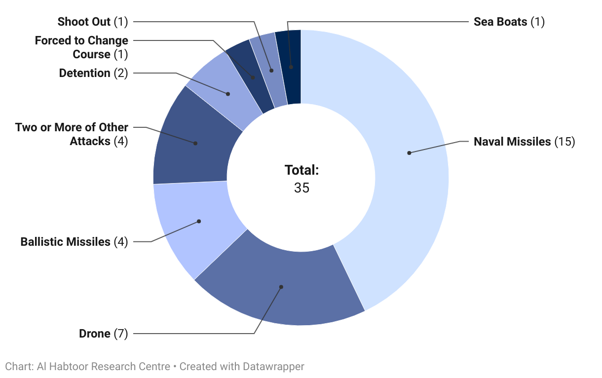
Between November 19, 2023, and January 29, 2024, a total of thirty-five ships were targeted. The series of attacks commenced with the seizure of the vessel ‘Galaxy Leader’ and concluded with the naval missile strike on the ship " ‘Lewis B. Puller.’
The majority of these attacks, totalling 75% of the incidents, were executed remotely using drones and missiles.
At least 19 of these incidents involved targeted missile strikes, prompting inquiries into the technology utilised by these missiles and drones to achieve precision hits.
Missiles rely on navigation systems to reach their targets, utilising either internal or external mechanisms. Among internal systems, the most notable is the Inertial Navigation System (INS) housed within the missile. The INS relies on measurements from acceleration sensors and gyroscopes integrated into the missile to track its target. Unlike external systems, the INS operates independently and does not require external assistance to navigate towards its objective. However, it is prone to inaccuracies, mainly when targeting moving objects such as ships, with deviations reaching up to 650 meters. Additionally, the INS incurs high manufacturing, maintenance, and preservation costs.
External systems utilised by missiles are commonly known as Global Navigation Satellite Systems (GNSS). These systems depend on constellations of satellites managed by various countries or international entities. The four primary GNSS systems include those operated by the United States, the European Union, Russia, and China.
| Name | Owner | Start Year | End Year | Number of System Satellites | Navigation Accuracy |
| Global Positioning System (GPS) | United States | 1978 | 1995 | 32 | 2-3 Metres |
| Global Navigation Satellite System (GLONASS) | Russia | 1982 | 1995 | 24 | 5-10 Metres |
| European Global Navigation Satellite System (Galileo) | European Union | 2002 | 2020 | 30 | 2-3 Metres |
| BeiDou Navigation Satellite System | China | 2000 | 2020 | 35 | 2-5 Metres |
- The Houthis cannot rely solely on the inertial system due to the moving nature and relatively small size of the targets compared to the system’s accuracy, as illustrated in the attached image.

- Additionally, it is not feasible to utilise the US and European systems as both parties prohibit access to them.
- Hence, the Houthis are left with no option but to utilise one of the Russian or Chinese navigation systems.
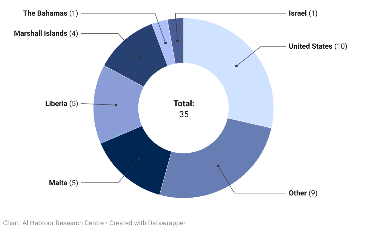
So far, no ships belonging to China or Russia have been targeted. However, it raises questions about whether the attacks would cease if the Houthis were prevented from using these two navigation systems. Additionally, it prompts consideration of whether the Houthis can sustain their obstruction of navigation without resorting to long-range targeting capabilities!
 3
3
 2
2
Read More


Comments